I used to be a tramper. These days when I study a map, discuss possible routes or consider gear and food options it will be with running in mind. I blame it on my need for speed, my love of the impromptu, a weakness for instant gratification, an adrenalin addiction, a restless nature and the feeling of intense satisfaction derived from spending a very long time on my feet confronting the uncertainty of whether what I’ve set out to do is possible. As Graham Greene noted, “when we are not sure, we are alive.” Maybe it’s a sign of old age that I find trainers more comfortable than boots, I prefer a light day pack to a heavy pack, that I’ve developed a fondness for my own bed. Whatever the reason, one thing’s for sure I’ve nailed a convenient excuse to consume copious quantities of two of my favourite “foods” chocolate and caffeine.
I know the exact moment when the switch flicked. It was December 2010 and I was running in my first ever trail race, an event dubbed “The Goat”. The weather was good, the terrain was rough and I was surrounded by lots of people clueless about how to run up muddy hills. I loved every second of the four plus hours it took me to complete the course. I knew I wanted to run more hill trails.
The Goat utilises a section of the Round the Mountain trail, “the Mountain” being Mt Ruapehu. I consider Ruapehu the back garden my taxes help pay for that I don’t have to weed. I’ve spent more time in it than any other garden. It’s where I first saw snow. It’s where I learnt to tramp, climb and ski. I’ve gotten lost there. I’ve been scared there. I’ve experienced great joy and a fair amount of misery. I’ve risked hypothermia, sunstroke and exhaustion. I’ve experienced calm, settled weather and frightening blizzard conditions. I’ve forged some of my closest friendships on the mountain. I’ve spent many weekends camping on its’ flanks, staying in huts, homemade snow caves and flash club lodges. I’ve used its’ slopes for teaching Snowcraft to fellow trampers and its many peaks as a training ground for alpine adventures further afield. During the winter months I’ve been known to study the mountain forecast, snow reports and avalanche advisories the way other people monitor cholesterol, blood alcohol or blood sugar levels.
Two years after doing The Goat I did a fast and light dawn Tongariro Crossing. A magic, solitary experience in stark contrast to crowded highway you’d normally encounter if tramping this route. Ever since I’d been thinking about doing a longer summer garden run so when some buddies suggested a Round the Mountain trip in early January I shelved my half formed South Island climbing plans, shoulder tapped my intrepid running mate Sarah and headed north.
On the day slated for our adventure I’m up at 3.30am to do final preparations and eat breakfast before the drive to Whakapapa Village. About 5.30am we park the vehicles at Ngaurahoe Place just below the Whakapapa Visitor Centre and commence jogging to the Silica Rapids Track on the Bruce Road. Our journey has begun.

The first 8.7 kilometre section of track to Whakapapititi hut is a straightforward amble on a well-formed track through beech forest stuffed with Kaikawaka and cabbage trees. There are occasional glimpses of Ruapheu’s glossy summer snow coat for inspiration but I’m short of caffeine and my first problem of the day comes when I spot my gear hemorrhaging out the top of my pack. I’ve zipped my pack up to the top instead of the side and the pressure of a full pack has opened the zip. Cursing I back track to retrieve various items of clothing that have escaped onto the track then increase my pace. Any catch up is thwarted when I reach the Whakapapititi River just below the hut. For reasons unfathomable my half asleep brain thinks that I should look for a crossing point that will guarantee dry feet. Of all the guarantees available in life dry feet would not make the top 1000 contenders even if you live in a desert so inevitably I emerge from the river with wet feet much to the bemusement of Ben who is patiently waiting for me. His facial expression conveys perfectly he is wondering what the hell I am doing mixed with the dawning realisation that a person of questionable sanity has stowed away on his trip.
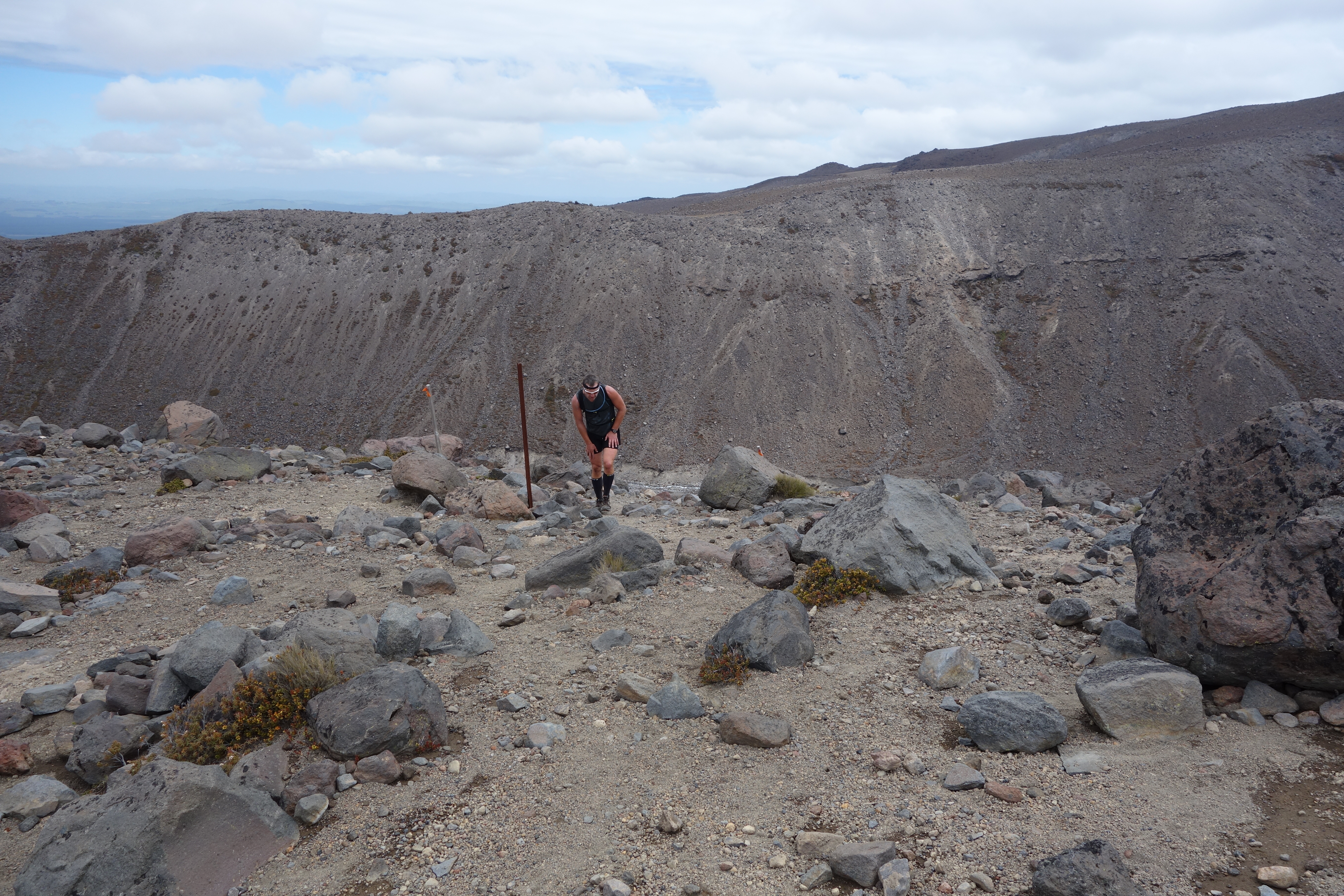
At Whakapapititi hut the rest of the group is itching to continue so the instant I emerge from the hut having downed the first of many gels for the day we are off. It has already become apparent that even without organisational faux pas my quest to record the journey pictorially is undermining my ability to keep up. Almost immediately I’m falling behind again and with the sun in my eyes I fail to spot the shortcut taken by the other four and in my haste to catch up I head up the Goat track. Ascending past a sign that I pause to read but not comprehend I wonder why I can’t see the others above. I’m on a westward path now which will take me back to Whakapapa Village somewhat earlier than planned. Fortunately I’m pulled up by loud yelling from below. A few polite hand gestures conveying the message that I need to get my arse back down the hill and back onto the Round the Mountain trail if I wanted to complete the 72km traverse today. Suitably chastised I slink back down the hill.

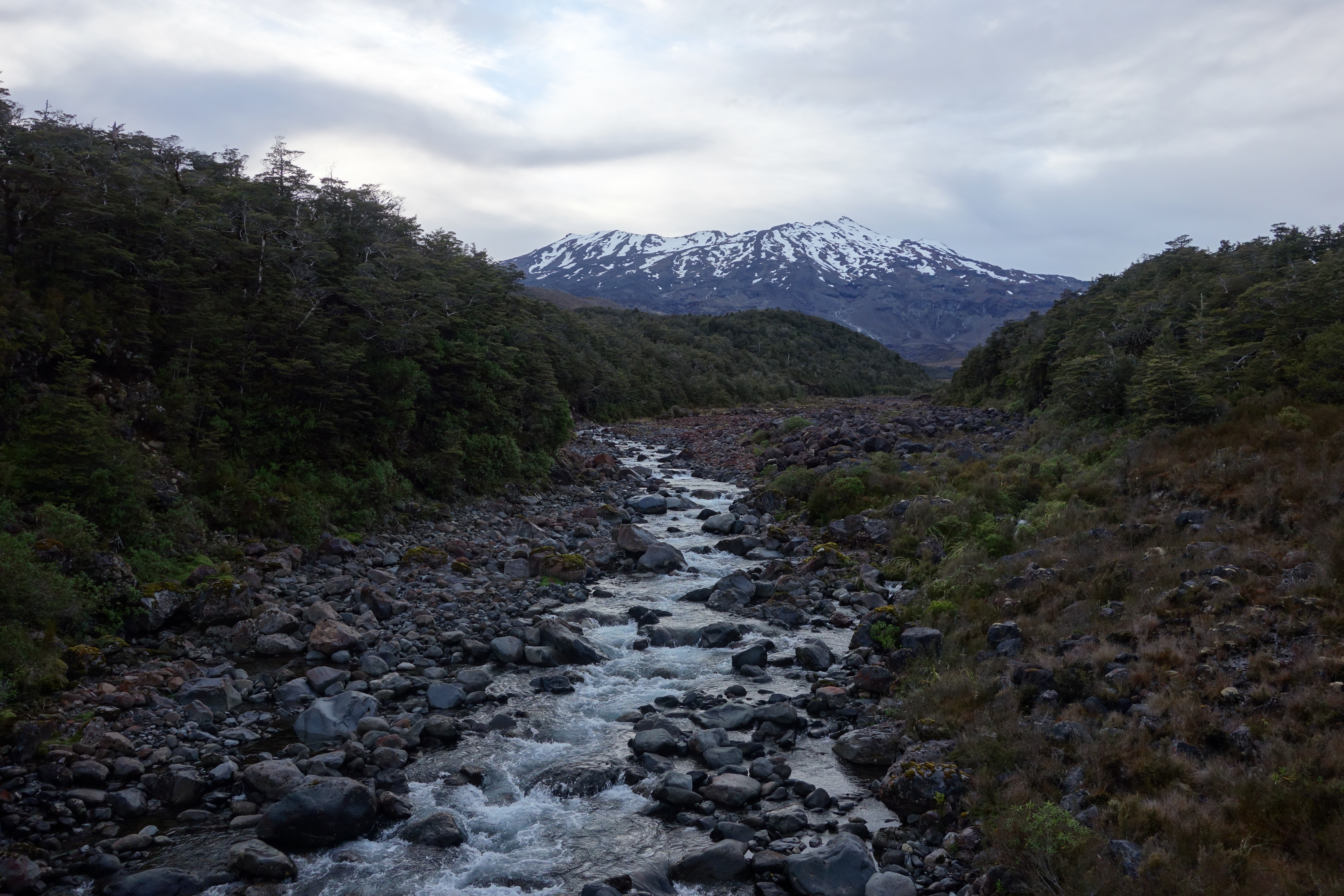
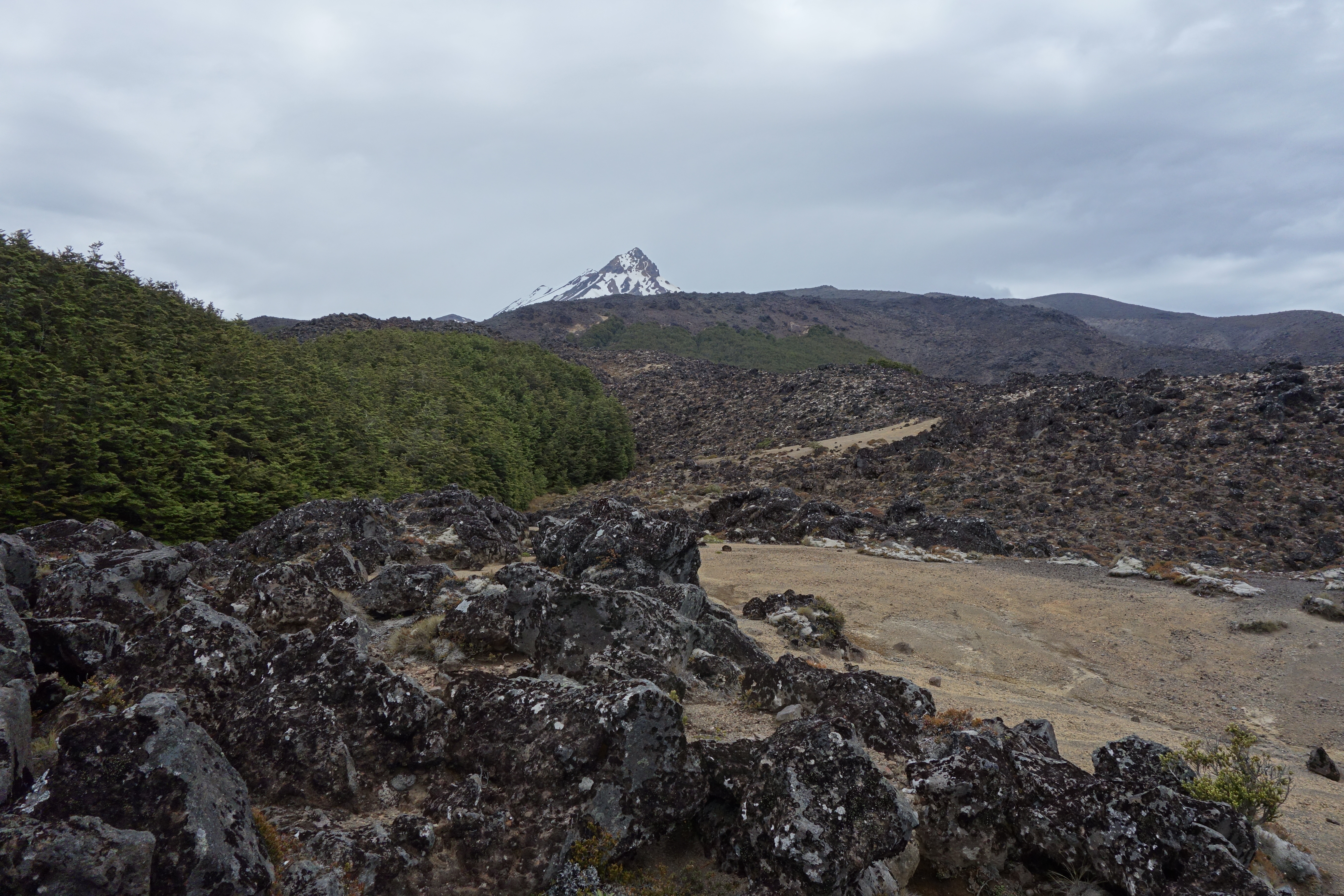
My new resolution is to keep the others in line of sight as we travel the 10.3km east across the Goat track to Mangaturuturu Hut. The Goat incidentally is a 20km trail race from Whakapapa Village to the Turoa ski field. This section of track is rough, technical and hilly but the views are amazing. This second leg of the Round the Mountain track traverses two river valleys, the Manganui-o-te-Ao and the Makatote. The scenery on offer includes views of Hauhungatahi a conical peak to the north-west of Ruapehu, spectacular waterfalls tumbling off lava bluffs in the Whakapapiti valley and Paretetaitonga one of Ruahpehu’s many peaks. Gritty looking brown mini canyons that plunge straight down into ravines leave me feeling I could be on the set of a western movie except for the piles of lava loosely assembled to form ridges that also dominate the landscape.

A third of the way through this leg we are rewarded with glimpses of Mt Taranaki. Little pearl shaped alpine tarns glisten modestly amongst the tussock. They would be easy to miss if you were concentrating on foot placement and keeping the worst of the mud off your trainers, preoccupations I have long since abandoned.
I know the hut is getting close when I pass Lake Surprise. From here the track descends steeply on a staircase boardwalk designed to protect the fragile alpine environment. Till now the trail has been dominated by signs of significant erosion and I’m pondering whether DoC will allow the Goat race to continue in its present form and whether more board walk is scheduled for installation. It would be a real shame if the track had to be closed due to vegetation damage. As I’m contemplating the final precarious and muddy descent I ‘m hailed by a couple of friends who coincidentally, are tramping around the mountain. They launch straight in with some good-natured teasing when I admit that I am attempting to circumnavigate the mountain in a single day. Their advice, run a bit faster and catch up to the girl plus three cute guys in matching sox up ahead!
A few steep rocky scrambles later and I cross the Mangaturuturu River. The river was scoured out in the mid-1970s by a lahar so there is no vegetation on the river bank, a stark reminder that we are not just circumnavigating a mountain but an active volcano. I amble on to Mangaturuturu hut where I can tell the endorphins are starting to kick in as I’m greeted with big smiles. The day is starting to warm up and the next section up to the Ohakune Road is eagerly anticipated. First though I have to listen to my instructions from the Matching Sox Trio. “Do not go up the Ohakune Road to the Turoa ski field like you do on the Goat. Do not go down the Ohakune Road to Ohakune for a coffee. Go only 3km down to the Blyth Hut turn off. We will wait for you there.”

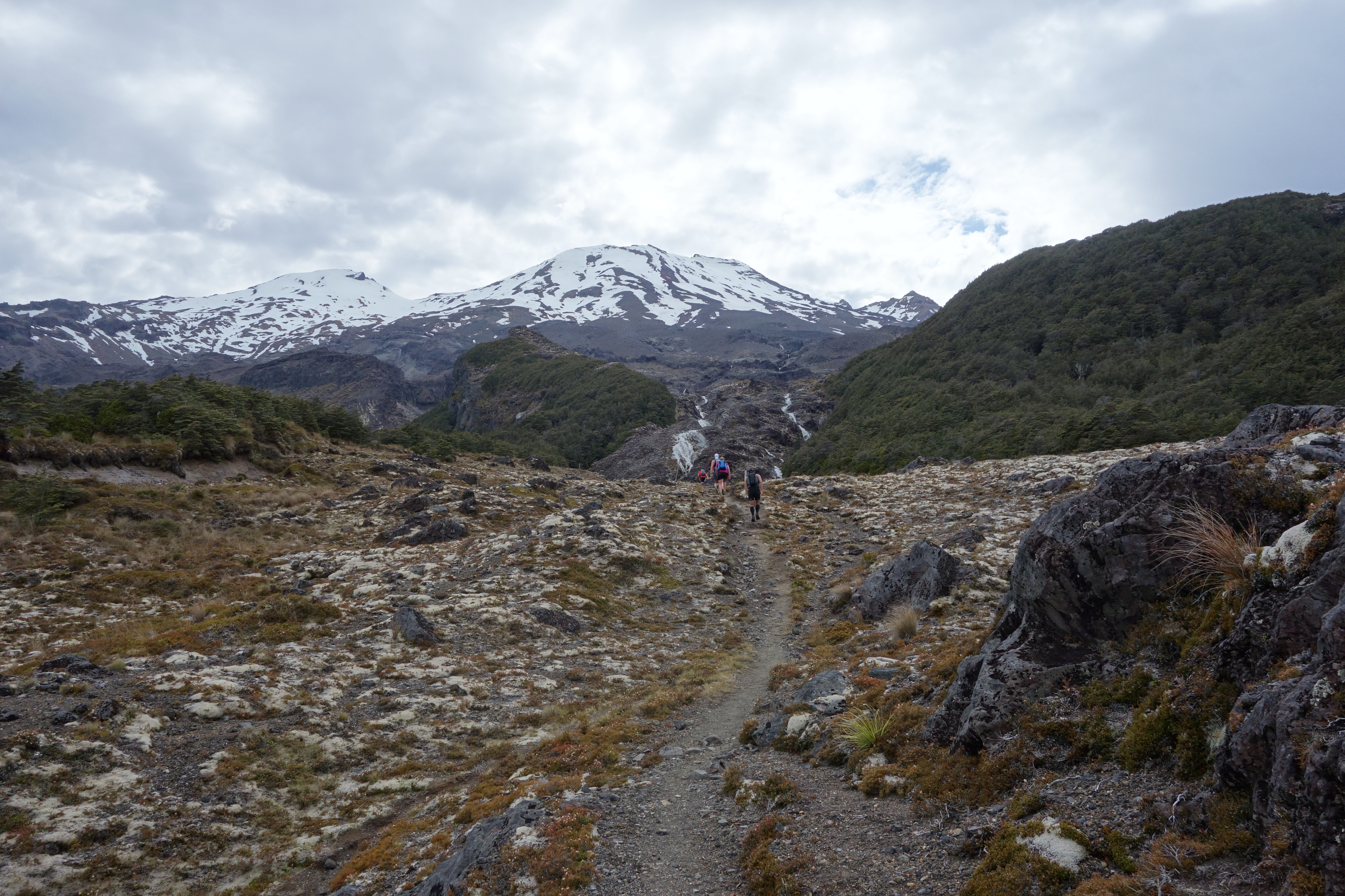
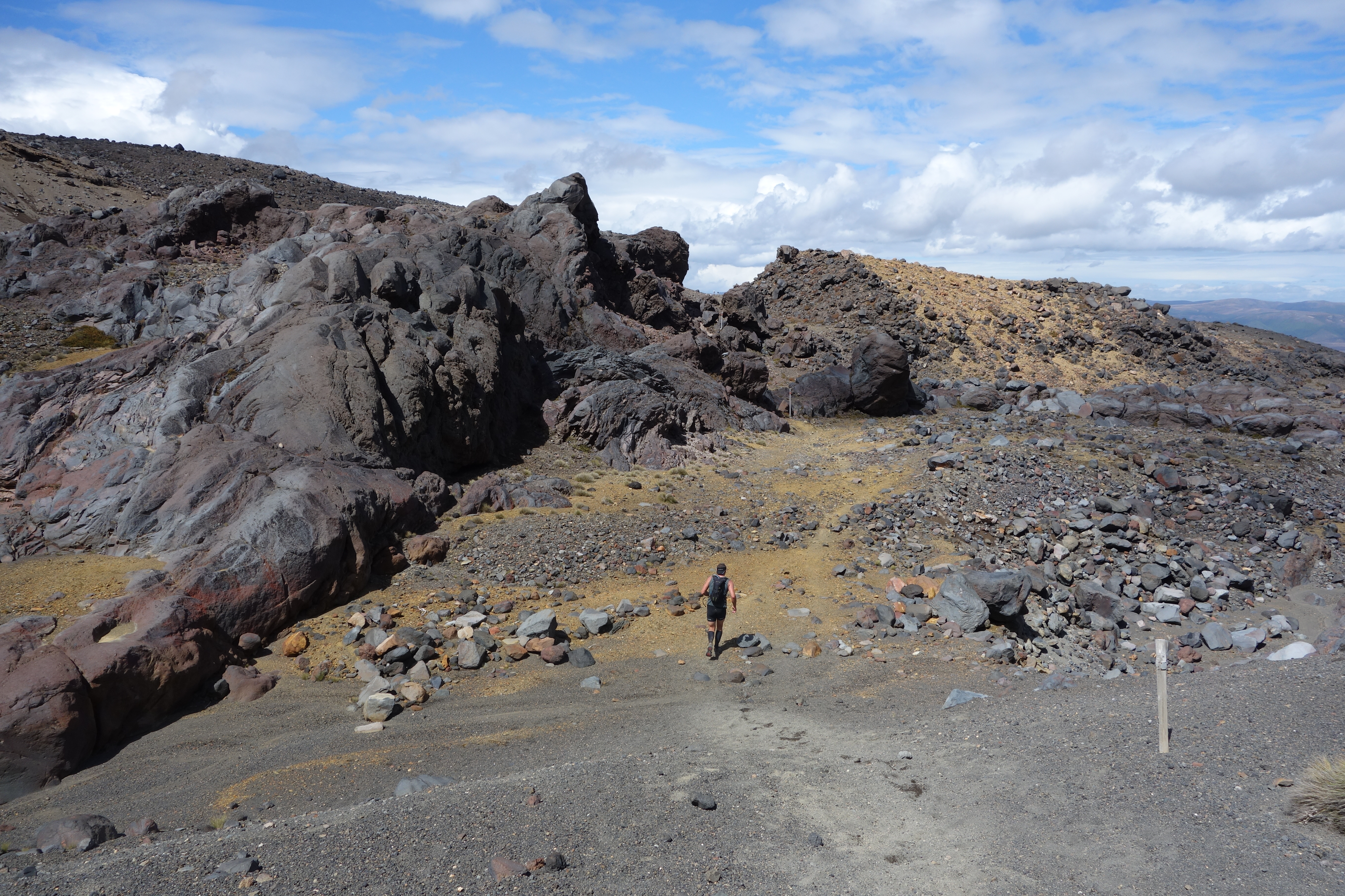
I take loads of photos as we head up the Mangaturuturu valley and up the Cascades waterfall. Silica deposits in the stream have coated the steep rock face the colour of cappuccino froth which reminds me it’s time to down a caffeinated gel. As we slip and slide our way up the wet rocks my confidence in my shoes turns out to be slightly misplaced as I take a slide and with it secure a gash to my left shin. Ouch! From the top of the Cascade we take the track up the Makotuku valley to the road crossing a lava ridge coated in alpine herbs to do so. Running down the asphalt to Blyth hut turnoff is hard on the joints and possibly the low point of the trip, thankfully it is over quickly.
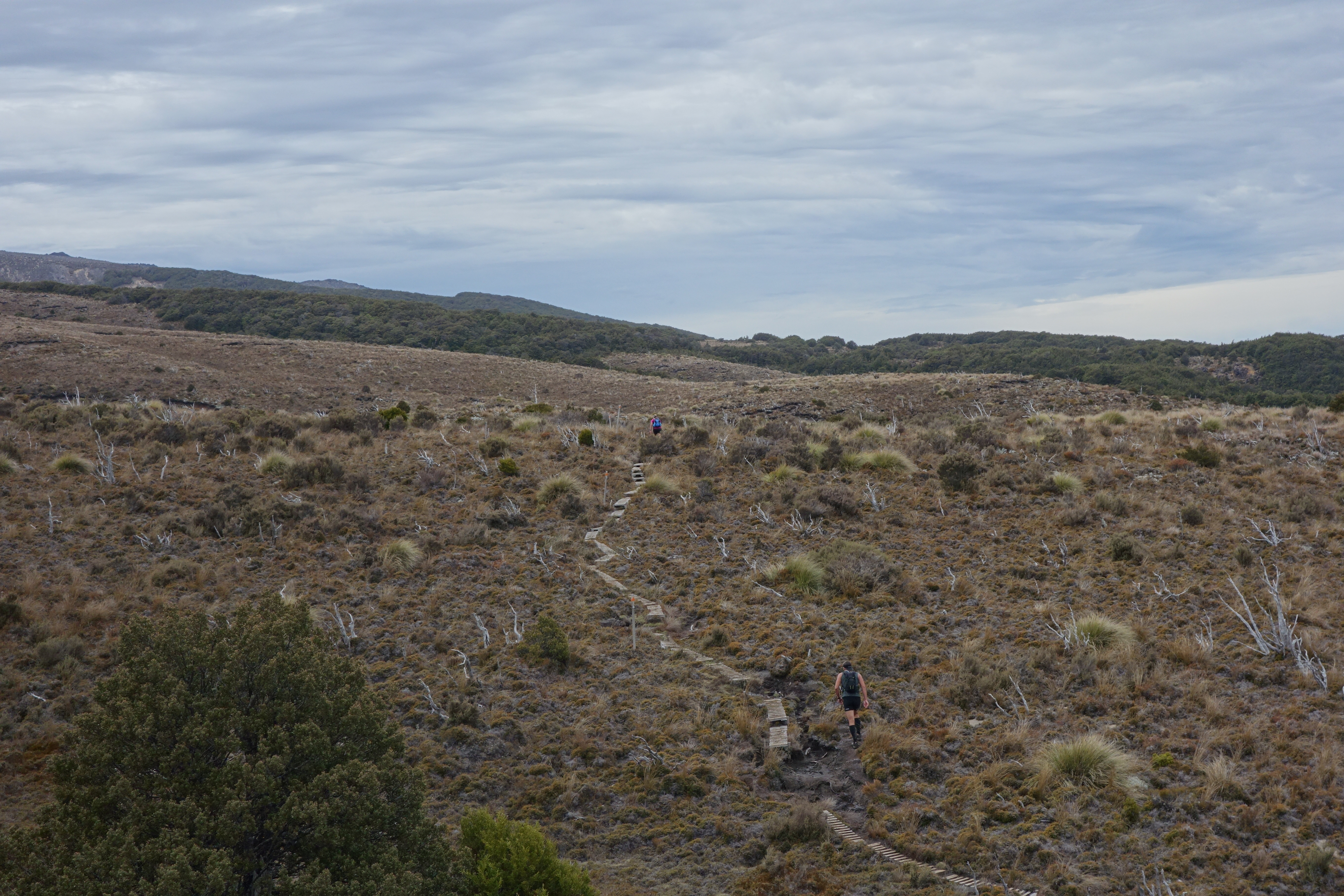
At the Blyth hut track entrance I munch on a cheese and avocado sandwich and persuade one of the vast hoards of Scouts waiting with us that he needs to take the Crazy Lady’s picture. I’m less successful in my attempts to recruit anyone to repeat the Round the Mountain trail in a Sherpa capacity. From the road we have 8.9km of relatively easy trail to Mangaehuehu Hut. This section is dominated by mountain beech forest and open alpine tussock country with a smattering of alpine bog thrown in meaning we have clear vistas east to the Desert Road and beyond. I wonder how many of the motorists who drive up and down SH1 have been in here to experience the magic of the vegetation on the mountain’s flanks up close. The gradual downhill traverse feels like a rest. Our perspective on the mountain is changing too, now views of Pare are replaced by the pointy outlier peak of Girdlestone reminding me of many engaging climbing trips from winters past.
At Mangaehuehu hut I down a second cheese and avocado sandwich and the team gives Ben some stick about his collection of pills and potions which are spread out across the veranda backcountry chemist shop style. Martini helps himself to a few samples of the little white pills while the rest of us top up our camelbaks with water in preparation for travel in the mountain’s rain shadow and chat with a friendly tramper who also takes our picture. More banter ensues as we note that Martini has applied Paul’s special industrial strength sunscreen so liberally he could be mistaken for a black and white minstrel. The next stage has us filled with anticipation and excitement as none of us have ever crossed from Mangaehuehu to Rangipo hut.


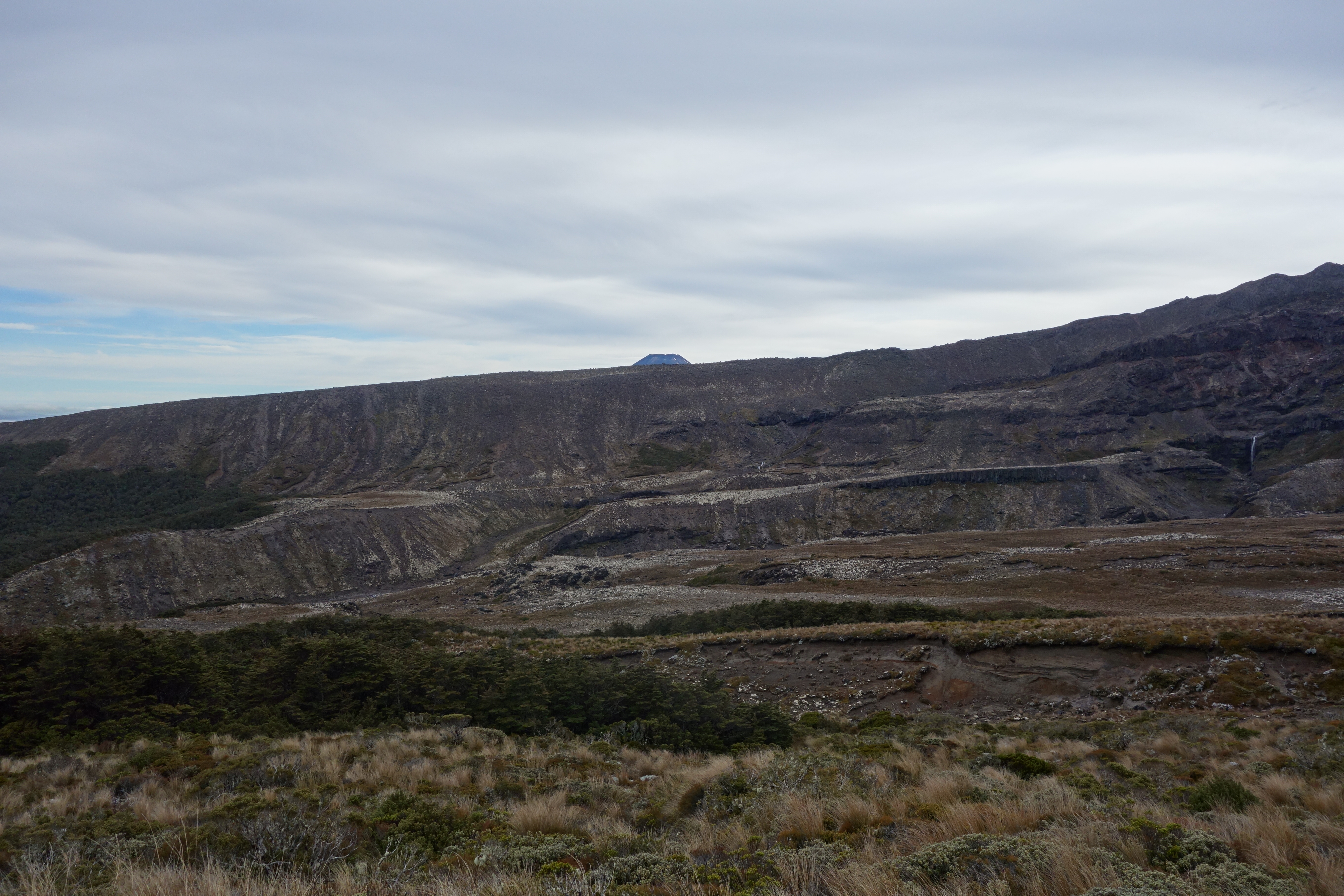
This section is an undulating traverse crossing first the huge Waihignoa Gorge which cuts a path down the mountain into the Karioi forest then through mountain beech on Ruapehu’s southern flanks followed by the Rangipo desert proper. The gorge is actually bigger than the nearby Whangaehu Valley where lahars are known to sweep down the mountain. I’m enchanted by the variety and richness of the shades of green and brown on display in the alpine shrubs in stark contrast to the uniform speckled black and white of the lava chunks strewn everywhere. There is an impressive opulence to the textures on display. Glossy silica deposits and crumbly, coarse sandstone that varies from black through to brown, lemon and gold in places. The tall blue marker poles scream the way as we cross several enormous swing bridges spanning dry creek beds that no doubt fill up quickly when it rains or during snowmelt.

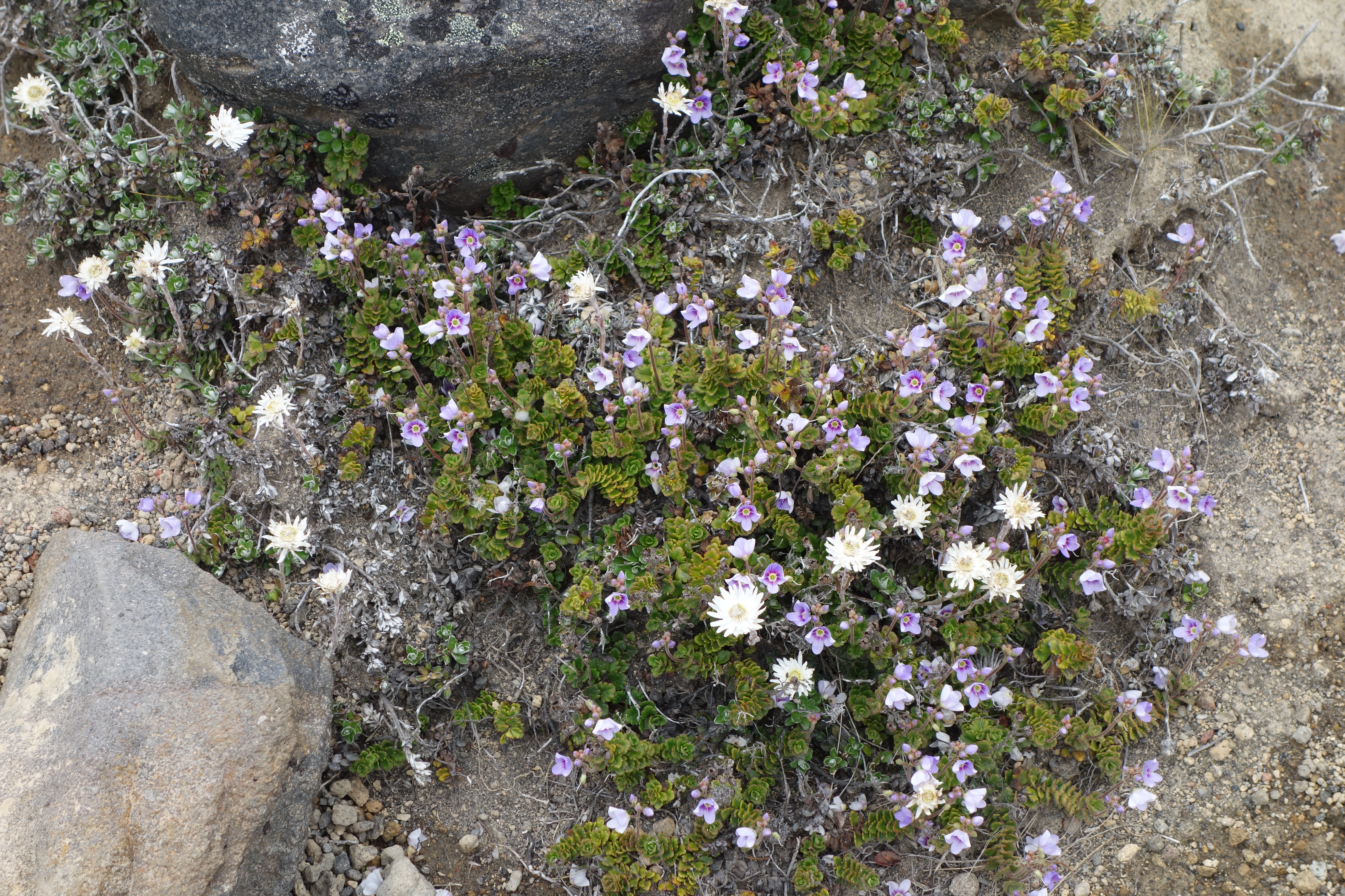
Working our way up and down the piles of rocks is tiring work and Sarah takes a confidence sapping fall. For once I’m in my element as I don’t mind rocks and the landscape has opened out giving a superb sense of space with a moody blue cloud dappled sky above offsetting the brown infused colour palate below. I take pictures of the alpine flowers in bloom – lovely shades of mauve and white.
As the day wears on the group is starting to tire. Paul and Ben’s waits for the rest of us to catch them up are starting to get longer while my experience with long days climbing and tramping mean that I’m no longer tail end Charlie. When I arrive at the hut very hot I’m surprised to see Paul and Ben wearing all their clothes but this is just testimony to the length of time they have been sitting around chatting with other trampers. Fortunately Rangipo hut which is nestled between to lava ridges is the perfect venue for a pause as it sports the best outlook of all the round the mountain huts with sweeping views out over the Kaimanawas to the east, the entire Rangipo Desert and the Desert road beyond.

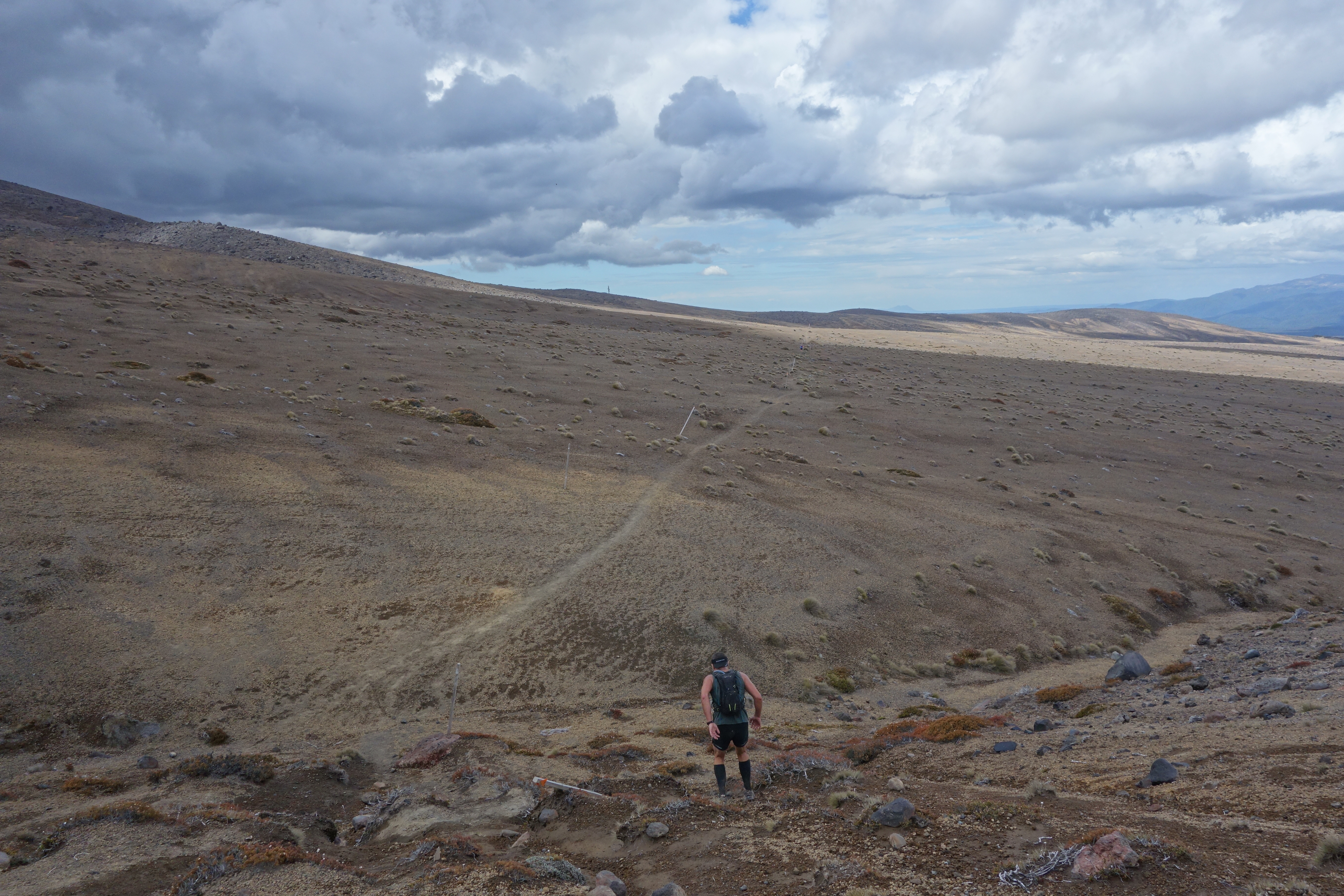
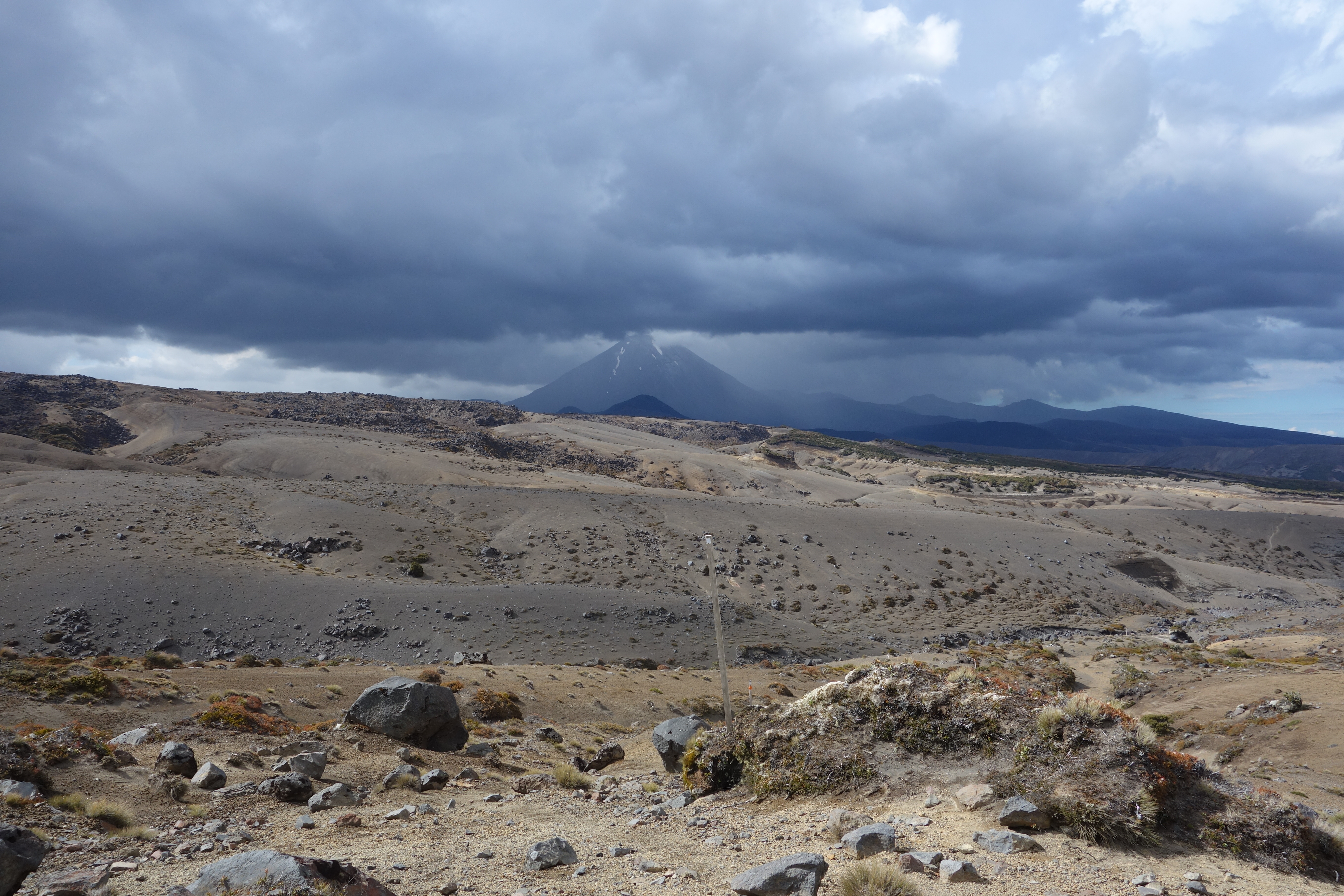
From Rangipo hut we have 12.5km round to Waihohonu hut. This penultimate leg turns out to be my favourite, gradual erosion of energy levels notwithstanding. The Rangipo desert is the only true desert in the North Island. We pass the Whangaehu River , various lahar warning signs and the Tukino Mountain road as we skirt the eastern flanks of the mountain and Ngaurahoe hoves into sight in the distance like a long-lost friend. The travel is the easiest we’ve had all day with lava rock giving way to vast plains of wind sculptured sands and pink and grey volcanic rock. The colours continue to amaze and delight me in equal measure. Little rock cairns mark the way in case you miss the tall blue marker poles. The sky has threatening dark clouds building up in it now but the forecast rain doesn’t eventuate. We are incredibly lucky with the weather. We learn later that it actually snowed on Ngaurahoe briefly, hard to believe given the humid conditions we experienced.
With Ben and Paul far ahead Martini and I contented ourselves with keeping Sarah’s bright pink shirt in line of sight and we swap camera duties to give each other rests. We’re now on the route used for the Tussock Traverse trail run. That event is now on my “to do” list. The scenery is magnificent. DoC and volunteer groups have done tremendous restoration work here planting acres of alpine vegetation.
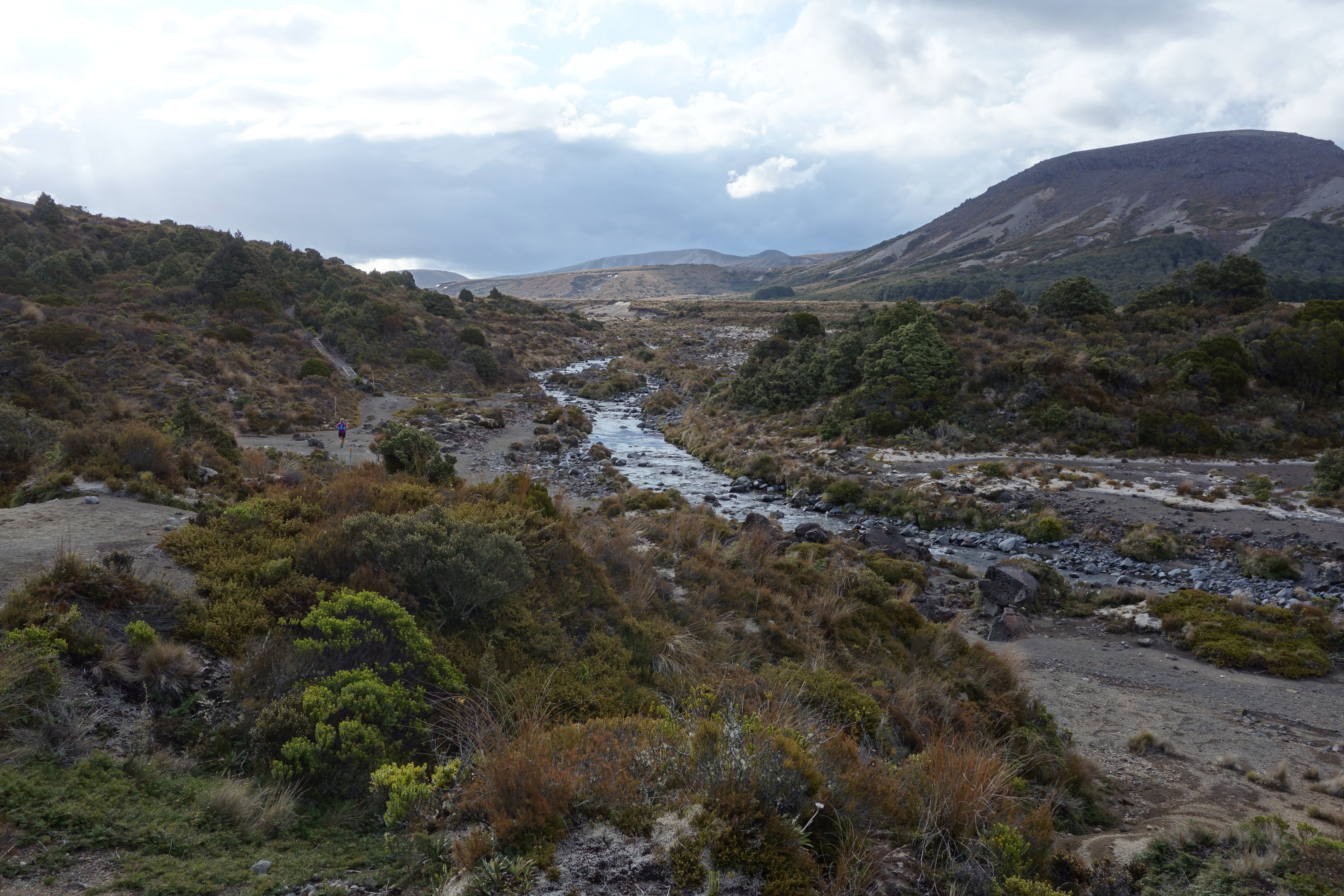
Waihohonu hut is huge as it caters not only for walkers doing the round the mountain track but also the more popular northern circuit plus it is a manageable day walk from Whakapapa Village. Upon arrival we’re greeted by a crowd of trampers relaxing after dinner and preparing to enjoy the sunset. They are unsure how to take the five smelly, grimy, sunburnt, hungry, dehydrated, exhausted strangers with wild eyes and uneven gaits who keep sucking on gels and claim to have come from Whakapapa Village the long way. Chris the friendly hut warden is unfazed joking about being an experienced aid station worker having volunteered on the Kepler previously. He brings us glasses of water which is much appreciated after a steady diet of sweet tasting electrolyte drink sucked from a tube. To cheers and waves we finally launch ourselves into the final leg out to Whakapapa Village.

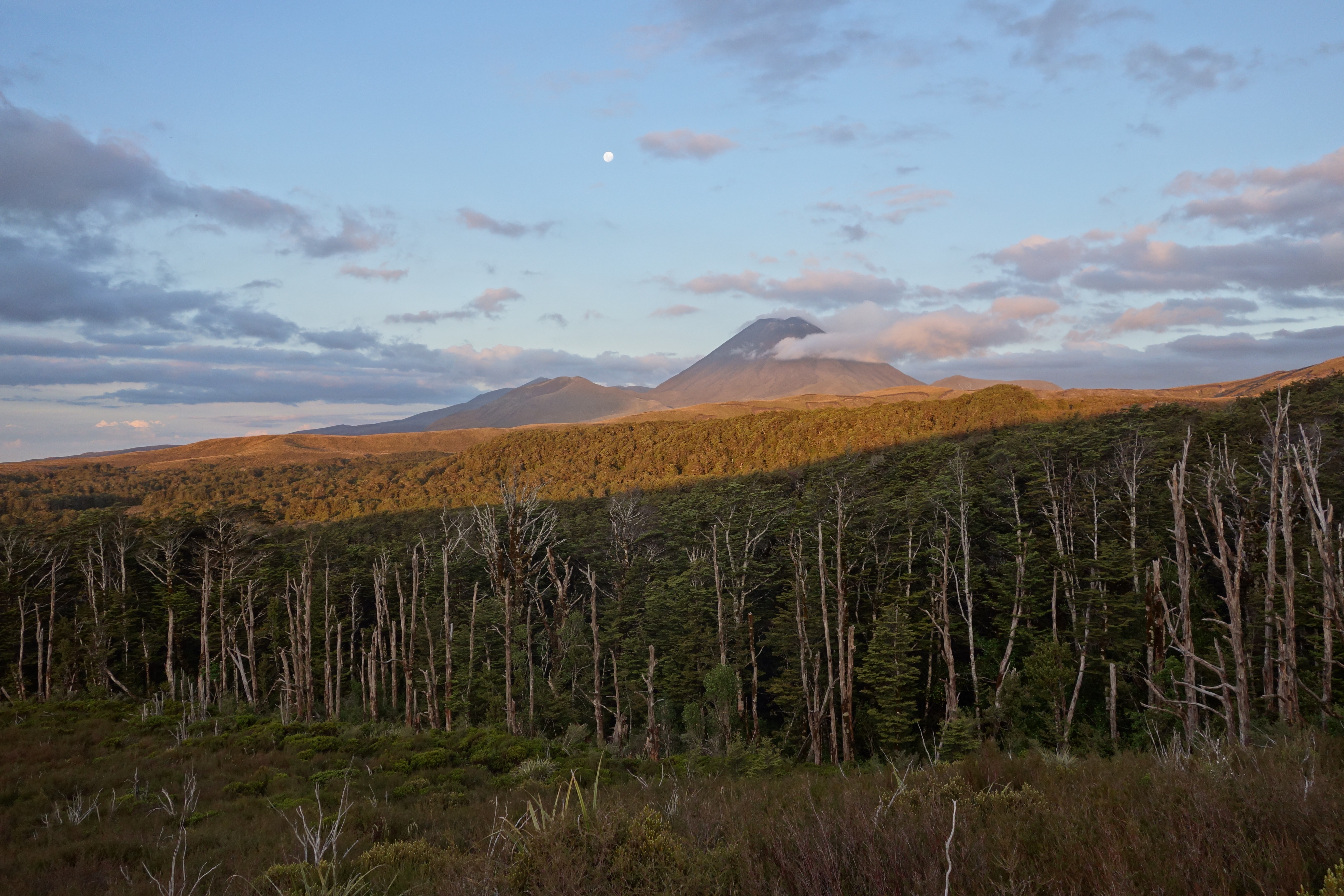
The last 14.3km would be easy running if not for the 12 hour pre-fatigue factor. Paul has run in previously in a time of 1 hour and 40 minutes. I have taken the opportunity to give Paul and Ben some instructions for a change. “No more waiting. Head off home so you don’t get cold, stiff and hungry. We will txt when we’re done.” With the pressure of keeping up off it’s just a case of mind over body now as Martini, Sarah and I gradually ascend beside the Waihohonu stream to Tama Saddle past the Tama Lakes turn off and across the plains with Ngaurahoe gradually looming larger and larger on our right. The subtle light playing on Ngaurahoe as the moon rises behind the volcano is a highlight of this leg and I can’t take enough pictures as we shuffle slowly towards the end of our journey. There have been so many serendipitous aspects to this adventure that I’m not really surprised when the car park and sunset arrive simultaneously.
We are tired but elated. We’ve seen the sun rise and set, experienced our energy ebb and flow. We’ve overcome numerous physical and mental challenges along the way and seen some amazing sights. For the most part we’ve done it together supporting, teasing and inspiring each other in equal measure. If I ever need a reminder of why I run I will draw on the memories from this trip. It’s been an unforgettable journey spanning 15 hours and 72 kilometres exploring new places, seeing familiar places from a fresh perspective, testing personal limits, forging new friendships, of heightened awareness, and of experiencing the highs and lows of living fully in the moment.
A Footnote on Times and Safety
During trip planning Paul estimated the circuit would take between 12 and 16 hours, the latter being the time for weekend warriors. He was spot on with the run taking him and Ben 12 hours and 10 minutes. The run is best done in an anti-clockwise direction so you get the most technical terrain done while you are freshest. There are huts at regular intervals for water but no easily accessible natural water sources on the eastern side between Mangaehuehu and Waihohonu huts. The run is through an alpine environment and around a volcano. For the most part it’s quite remote and you must cross two well-known lahar paths. The weather can change quickly and dramatically so take appropriate clothing, food and equipment. You may need to navigate relatively featureless terrain in poor visibility. Cell phone reception is generally good. The main escape routes are the Ohakune and Tukino skifield roads, the latter is only accessible by four-wheel drive. If you chose to undertake the route outside the summer season you are likely to need alpine kit.

Hey there I am so happy I found your blog page, I really found you by mistake, while I was browsing onn Aol for something else, Nonetheless
I am here now and would just like tto say kudos for a incredible post and
a aall round entertaining blog (I also love the theme/design), I don’t have time to
read it all at the moment but I have book-marked
it and also added your RSS feeds, so when I have time I
will be back to read a great deal more, Please do keep upp
the great work.
LikeLike